The official Sea Level Affecting Marshes Model (SLAMM) web site is located at:
http://www.cteco.uconn.edu/projects/SLAMM/
Below are some of the highlights.
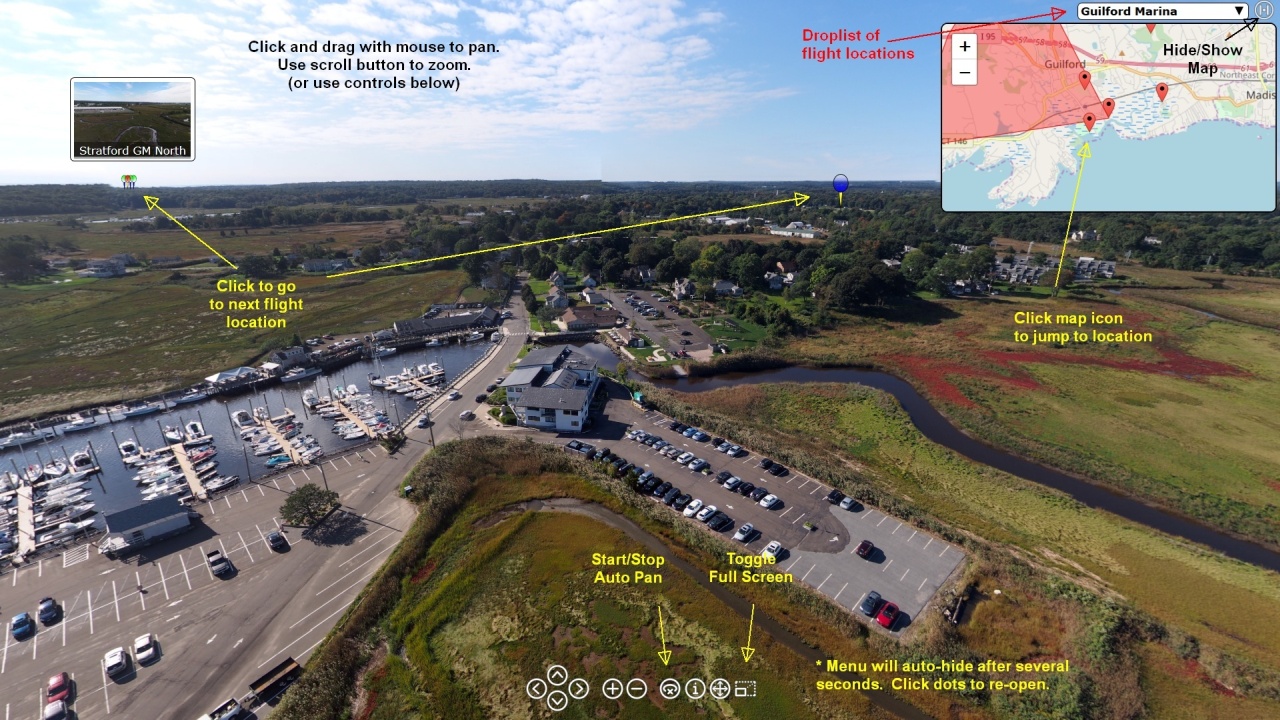
Panoramas (hosted on UConn CT ECO):
- Combined (SLAMM Site) Panoramas (all three towns)
- Direct links to each town : (Stratford, Guilford, Old Saybrook)
Click here for panorama instructions
Selected Photographs (hosted on this web site):
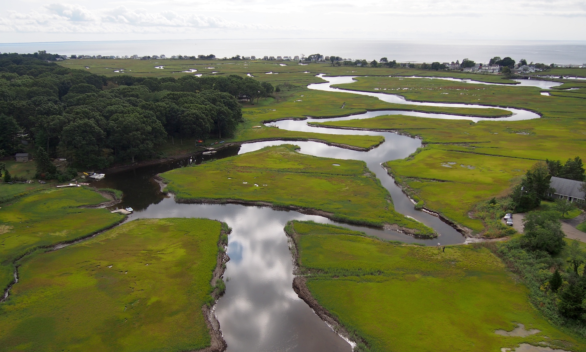
- Old Saybrook (flights 09/20/2018)
- Stratford Great Meadows (flights 09/27/2018)
- Guilford (flights 10/05/2018)
- Map captures of Flight Locations
- Stitched Photos (from sets of photos captured to cover larger areas)
*These gallery images are medium resolution, and just a few of many. All of the images captured are now available as links through the Marsh Photos point layer on the SLAMM map site http://s.uconn.edu/slammviewer.
09/06/2019 (prev update 03/22/2019)